
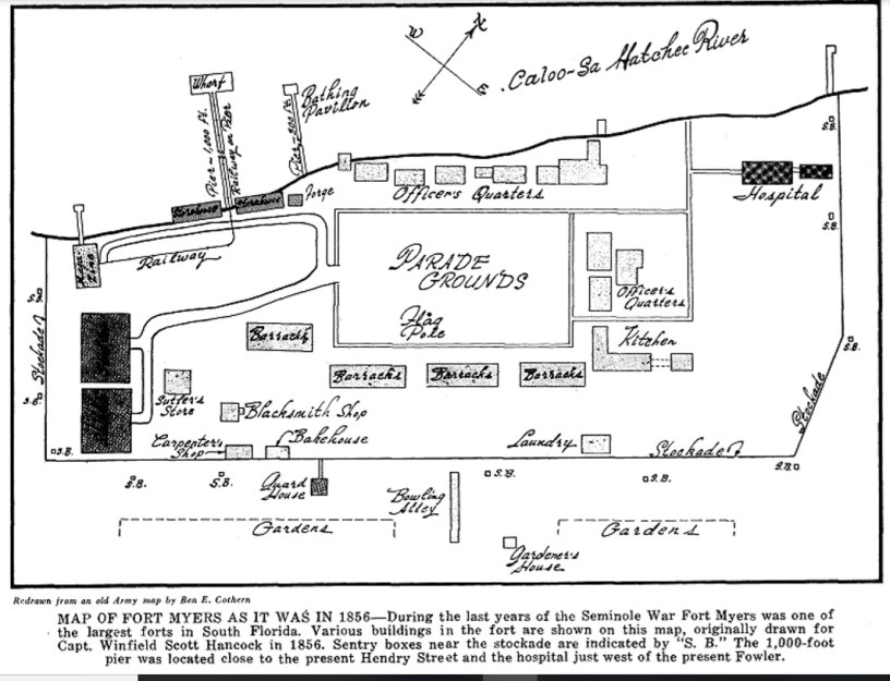
MAP OF FORT MYERS AS IT WAS IN 1856 during the last year of the Seminole War. Fort Myers was one of the largest forts in South Florida. Various buildings in the fort are shown on this map, originally drawn for Capt. Winfield Scott Hancock in 1856. Sentry boxes near the stockade are indicated by ”S. B.” The 1,000-foot pier was located close to the present Hendry Street and the hospital just west of the present Fowler.
Grismer, Karl H. The Story of Fort Myers: The History of the Land of the Caloosahatchee and Southwest Florida. St. Petersburg Printing Company, Inc. Florida. 1949. (redrawn from an old Army map by Ben E. Cothern)

